

2nd Cycle: Geodesy and Geoinformatics MSc
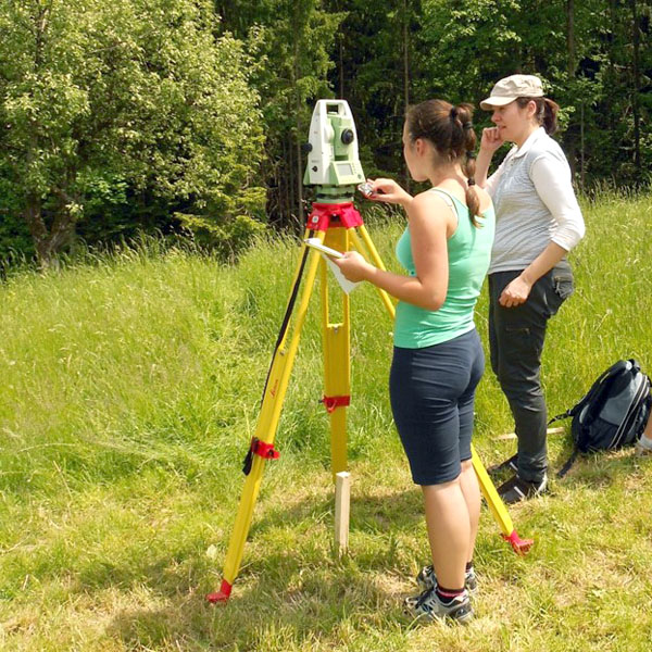
The basic goal of the second cycle master study programme Geodesy and Geoinformatics is to educate experts capable of analytical and synthetic thinking, creative, critical, efficient and constructive solving of complex research and development problems and project-applied tasks in the fields of geodesy and geoinformation. The program ensures interdisciplinary integration of the experts and at the same time it provides excellent foundation for further studies at the third cycle of any natural science and technical programmes. At the same time it enables students to obtain a license of Responsible Surveyor by the Slovenian Chamber of Engineers. The study programme provides students comparability of educational attainment also in an international context.
places for master study programme Geodesy and Geoinformatics (MSc)
Basic goals of the study programme
The basic goal of the second cycle master study programme Geodesy and Geoinformatics is to educate experts capable of analytical and synthetic thinking, creative, critical, efficient and constructive solving of complex research and development problems and project-applied tasks in the fields of geodesy and geoinformatics. The programme ensures interdisciplinary integration of the experts and at the same time, it provides excellent foundation for further studies at the third cycle of any natural science and technical programmes. At the same time, it enables students to obtain a license of Responsible Surveyor by the Slovenian Chamber of Engineers. The study programme provides students comparability of educational attainment also in an international context.
General competences
General competences acquired by the graduates of the master study programme Geodesy and Geoinformatics are:
- generally well-informed experts, knowledge about academic areas and scientific work methods,
- critical reading and understanding of texts, independent upgrading of knowledge and search for sources,
- ability to transfer and use theoretic knowledge in practice
- development of high professional and ethical standards and professional, environmental and social responsibility,
- development of scientific literacy, skills of public appearance and communication with clients, transfer and presentation of knowledge and results,
- ability to use domestic and foreign professional language in written and oral communication, communications in international and national scientific circles,
- ability to use and develop geo-information technology,
- capacity to manage professional processes in the surveying companies, public services or agencies in the fields of geodesy or spatial planning.
Course-specific competences
With the second cycle master study programme Geodesy and Geoinformatics the graduate acquires mainly the following course-specific competences:
- independently solves all kinds of professional and development tasks in the fields of geodesy and geoinformatics
- understands, applies and develops modern surveying methodologies and technology and is able to upgrade it,
- plans, organizes, manages and carries out surveying tasks for the establishment, maintenance and restoration of the basic geodetic reference system,
- plans, organizes, executes or leads geodetic works:
– in the land surveying,
– in the construction of all types of buildings or generally in all types of infrastructural development in the physical environment,
– in the procedures of cadastral regulation and registration of real estate,
– in the fields of topography and cartography,
– in the fields of photogrammetry and remote sensing,
– at the establishment, maintenance and upgrading of geographic, cartographic and land information systems - participates in the preparation of spatial planning documents and
- knows the legal, administrative and economic system, important for the surveyor.
Conditions for enrolment and selection criteria when enrolment is restricted
The second cycle master study programme Geodesy and Geoinformatics is available to the graduates from:
a) first cycle academic study programme Geodesy and Geoinformatics;
b) first cycle higher education professional study Technical Real Estate Management, who pass differential exams from the first cycle academic study programme Geodesy and Geoinformatics: Mathematics 2, Physics and Geodesy, totalling 20 credit points; the differential exams may be selected as elective courses during the first cycle study or in additional bridging year;
c) higher education professional study of geodesy before the introduction of Bologna programmes;
d) first cycle university study of other studies; the candidates shall finish additional individual bridging programme consisting of 10 to 60 ECTS. The obligations shall be defined according to the level of deviation of the basic area and the candidates may comply with the demands during the first cycle study or by passing exams before the enrolment to the master study.
e) first cycle higher education professional study of other related programmes (technical and geosciences); the candidates shall finish additional individual bridging programme consisting of 10 to 60 ECTS. The obligations shall be defined according to the level of deviation of the basic area and the candidates may comply with the demands during the first cycle study or by passing exams before the enrolment to the master study.
f) other related (technical and geo sciences) higher educational professional studies before the introduction of the Bologna programmes; the candidates shall finish additional individual bridging programme consisting of 10 to 60 ECTS.
Obligations of the individual bridging programme shall be defined according to the missing knowledge and the experiences of the candidate from practice acquired before the enrolment.
In case of restricted enrolment, the following conditions shall be considered: grade obtained in the first cycle study (100%).
Criteria for recognising knowledge and skills acquired before enrolment in the programme
The student can be acknowledged the knowledge that matches the contents and scope of the study in the programme Geodesy and Geoinformatics. The Study Board of the Department of Geodetic Engineering of UL FGG takes decisions regarding the acknowledgement of knowledge and skills acquired before the enrolment, based on the student’s written application, the enclosed certificates and other documents evidencing the successfully acquired knowledge and contents of this knowledge, and in accordance with the Rules on the procedure and criteria for the acknowledgement of informally acquired knowledge and skills, adopted on 29 May 2007 at the 15th meeting of the UL Senate.
For the acknowledgement of knowledge and skills the following shall be considered:
- certificates and other documents evidencing finished courses and other forms of education,
- evaluation of finished products, services, publications and other original works of the student,
- evaluation of knowledge acquired by the student based on self-education or learning from experiences (possibility of completing study obligations without participation at lectures, practical work, seminars),
- adequate work experiences.
In case that the Study Board of the department determines that the acquired knowledge may be acknowledged, this is evaluated with the same number of ECTS points as the number of credits in the subject.
Conditions for progression through the programme
Conditions for progression from one year to another
The student may enrol to subsequent year, if they complete by the end of the study year all the obligations foreseen by the study plan, amounting to at least 45 ECTS.
Exceptionally the student may enrol to subsequent year if he has completed all their obligations in accordance with the study programme and achieved at least 40 ECTS of the current year and if he has justifiable reasons as defined by the UL Statute. The UL FGG Commission for solving student applications decides on exceptional enrolment.
A student who shows above-average academic results in his/her studies is given the opportunity to advance faster. The decision on this is made by the Dean of UL FGG on the basis of the candidate’s application and the reasoned opinion of the Study Board of the UL FGG Department of Geodetic Engineering. The decision determines the method of faster advancement.
Conditions for repeat enrolment in the same year
Failing to meet all the obligations defined by the study programme for the advancement in the subsequent year, students may enrol in the same year for the second time, provided that they have obtained at least 30 credit points according to ECTS.
Requirements for completion of the study
Students finish the study by accomplishing all the prescribed obligations totalling 120 points according to ECTS. The graduate is awarded with the title magister inženir geodezije in geoinformatike (male) / magistrica inženir geodezije in geoinformatike (female), abbreviated as mag. inž. geod. geoinf. As reference only, the title acquired corresponds to the second cycle graduate in Geodesy and Geoinformatics.
Transfers between study programmes
Transfer between programmes shall mean termination of education in the student’s original study programme (first programme) and continuation of education in the second cycle master study programme of Geodesy and Geoinformatics (second programme), in which a part of the completed study requirements from the first study programme are recognised as completed.
Transfers are possible from the second cycle study programmes, and until their expiration also from the undergraduate academic study programmes adopted after June 11 2004, where the competences of the finished studies are comparable and according to the acknowledgement criteria at least half of the obligations according to ECTS from the first study programme related to compulsory courses of the second study programme can be acknowledged. Considering the scope of acknowledged obligations from the first study programme in the Republic of Slovenia or abroad student may enrol to the same or higher year in the second study programme. Transferring students shall fulfil the conditions for the enrolment to the second study programme.
Applications of candidates for the transfer to the second cycle master study programme Geodesy and Geoinformatics and the scope of acknowledged obligations in the study programme will be examined individually by the Study Board of the Department of Geodesy. If in the procedure of acknowledging obligations for the purpose of transfer the candidate is approved at least the amount of credit points and those point that are required for the enrolment to a higher year of the second cycle master study programme Geodesy and Geoinformatics, the candidate may enrol to the higher year of the second cycle master study programme Geodesy and Geoinformatics.
Methods of Assessment
Knowledge is examined and evaluated in individual courses. Accordingly, the teaching process in each course finishes with the examination of knowledge and acquired skills. The forms of knowledge testing (oral or written examinations, preliminary examinations, seminar works, work logs, practical assignments, projects, portfolios, peer evaluation) are defined in the study plans of individual courses. General rules of knowledge testing are regulated by the Rules on the first and second cycle studies at the UL FGG, adopted by the Senate of FGG. The details are defined by the Study Regulations.
The student receives a single grade of the exam, consisting of foreseen required obligations in each course. Each obligation shall be evaluated with a positive grade.
Knowledge from preliminary and partial examinations, seminars, seminar works, work logs, practical projects, home projects, homework and similar amounts to at least 30 % of the total grade.
According to the Statute of the University of Ljubljana the following grading scale is used:
10 – (91–100 %: excellent: exceptional results with negligible mistakes),
9 – (81–90 %: very good: above average knowledge with few mistakes),
8 – (71–80 %: very good: sound outcomes),
7 – (61–70 %: good: good knowledge, but with significant shortcomings)
6 – (51–60 %: sufficient: performance meets the minimum criteria),
5 – (50 % and less: unsatisfactory: performance does not meet minimum criteria).
The candidate's performance is considered successful for grades from satisfactory (6) to excellent (10).
Possibilities of elective courses and mobility
The master’s study programme Geodesy and geoinformatics foresees elective courses totalling 19 ECTS. Students shall select professional elective courses from the 2nd cycle study programmes Geodesy and geoinformatics and sports education. To complete practical knowledge, in the third semester it is appropriate to select Field Project Work. Elective courses are selected at student’s own discretion or among other elective courses at other master study programmes. In this respect, students are recommended to select courses from the areas of municipal engineering, traffic infrastructure as well as hydrology.
Students may also choose elective courses from other faculties that are members of UL, other universities and higher education institutions in Slovenia, or internationally. They are recommended to select courses from the areas of law, economics, administration and business administration, sensors, computer science, foreign languages, geology, geomorphology, agronomy, forestry, architecture and urbanism, etc. Subjects in the amount of 6 ECTS (5%) may be selected freely.
Students may transfer 30 ECTS credits of the programme (one study semester, regardless of compulsory and elective units) from any other geodesy and geoinformatics programme in Slovenia or abroad, provided that UL FGG has a signed agreement with the institution in question.
Syllabus – Geodesy and Geoinformatics (MSc) – 2nd Cycle

All study programs on Faculty of Civil and Geodetic Engineering are internationally certified from 2022 to 2029.