
Chair of Geoinformatics and Real Estate Cadastres
Katedra za geoinformatiko in katastre nepremičnin (KGKN)
The Chair of Geoinformation and Real Estate Cadastres (KGKN) focuses its educational and research work on the areas of Earth observation, geoinformatics and real estate management. Our work is strongly marked by new technological solutions for the acquisition and processing of mass spatial data as well as the role geoinformation that is gaining recognition in the society. Spatial data with geoinformation solutions have become indispensable in taking strategic and operative decisions and are the basis for sustainable development, land management and management of other natural resources, agriculture and forestry, logistics and tourism, risk management, and for taking actions in the event of natural and other disasters. The areas of the Chair’s activity have, as a consequence, explicitly an interdisciplinary character, which brings a lot of challenges and opportunities.
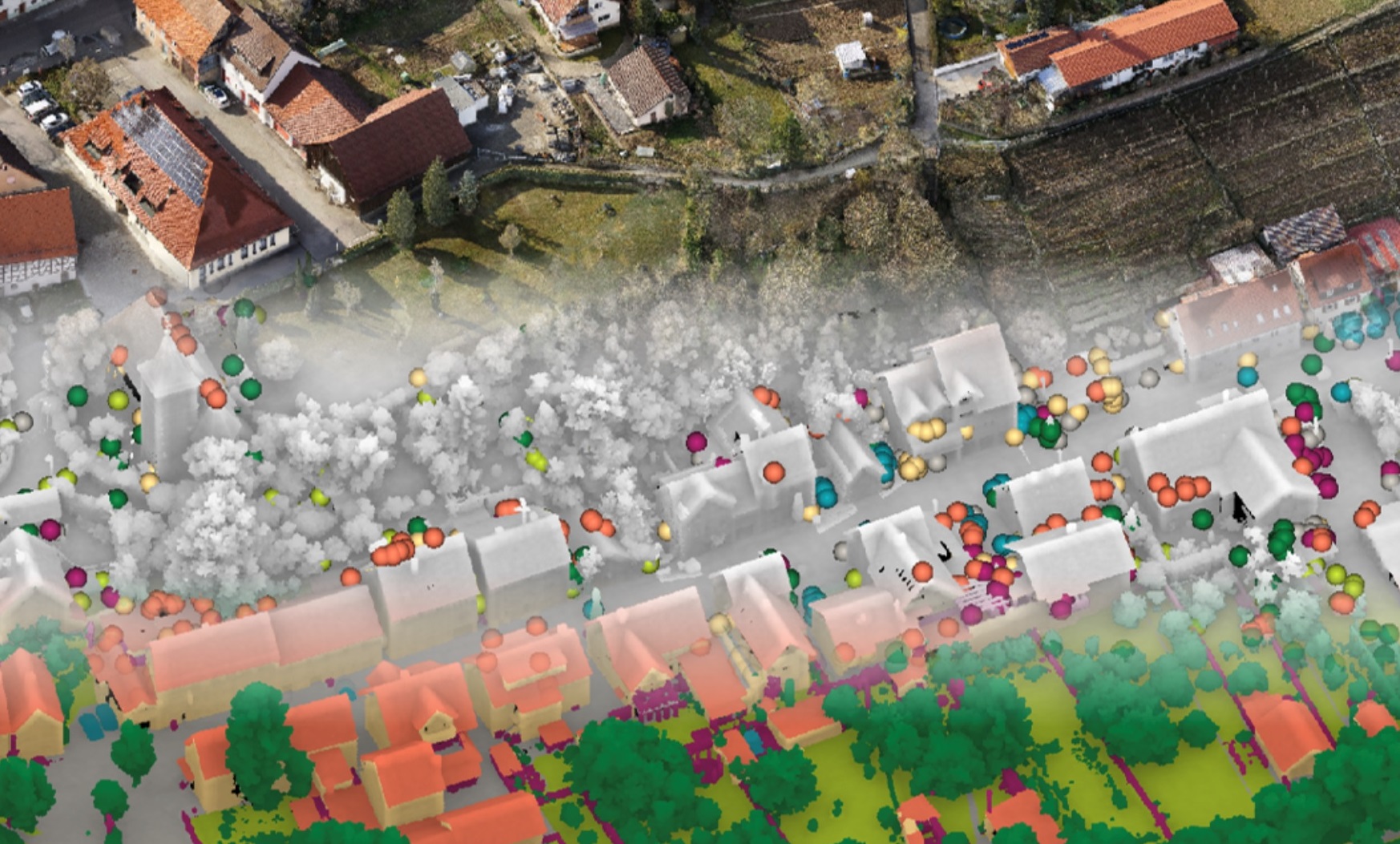
Scientific, research and professional work of our Chair is focused on spatial information modelling and monitoring of changes in space. The work is coordinated within the research group Geoinformatics and Real Estate Management and the core research programme Earth Observation and Geoinformatics (P2-0406). In the field of remote sensing, our work is focused on the processing of mass data using algorithms from data mining and machine learning, and on the time series analysis, where our main challenges are multispectral data of satellites Sentinel and the spatial data acquired by sensors in aircrafts and drones. As regards the information modelling of space, we are engaged in the development of procedures for the generation of topologically arranged 3D models and how to bridge the differences between BIM and GIS concepts (GeoBIM). Special attention is paid to the spatial analytics as a support to regional planning and real estate valuation. In the field of real estate administrative systems, our challenges are related to the development of a 3D cadastre, optimisation of cadastral real estate (re)arrangement and providing high-quality real estate data.

Chair members
| zaposleni | telefon | ||
|---|---|---|---|
| doc. dr. | Marjan Čeh, univ. dipl. inž. geod. | +386 1 4768 653 | marjan.ceh@fgg.uni-lj.si |
| asist. | Nina Črnigoj, mag. inž. geod. in geoinf. | nina.crnigoj@fgg.uni-lj.si | |
| izr. prof. dr. | Samo Drobne, univ. dipl. inž. geod. | +386 1 4768 649 | samo.drobne@fgg.uni-lj.si |
| asist. | Matija Gerčer, mag. inž. rač. in inf. | matija.gercer@fgg.uni-lj.si | |
| asist. dr. | Peter Golob, univ. dipl. inž. geod. | +386 1 47 68 561 | peter.golob@fgg.uni-lj.si |
| asist. | Tanja Grabrijan, mag. inž. geod. in geoinf. | +386 1 4768 561 | tanja.grabrijan@fgg.uni-lj.si |
| prof. dr. | Anka Lisec, univ. dipl. inž. geod. | +386 1 4768 560 | anka.lisec@fgg.uni-lj.si |
| prof. dr. | Krištof Oštir, univ. dipl. fiz. | +386 1 4768 650 | kristof.ostir@fgg.uni-lj.si |
| asist. dr. | Ana Potočnik Buhvald, mag. inž. geod. geoinf. | +386 1 4768 629 | ana.potocnik-buhvald@fgg.uni-lj.si |
| asist. - razisk. | Luka Stojanović, mag. geog. | luka.stojanovic@fgg.uni-lj.si | |
| doc. dr. | Jernej Tekavec, univ. dipl. inž. geod. | +386 1 4768 583 | jernej.tekavec@fgg.uni-lj.si |
| doc. dr. | Mihaela Triglav Čekada, univ. dipl. inž. geod. | +386 1 2002 900 | mihaela.triglav-cekada@fgg.uni-lj.si |
| strok. sod. | Barbara Trobec, univ. dipl. inž. geod. | +386 1 4768 561 | barbara.trobec@fgg.uni-lj.si |
Educational activity
In the field of education, the mission of the Chair is education of professionals who are able to solve problems in practice and as well as in research work, in the field of geoinformatics and real estate administration, which includes implementation, maintenance, protection, standardization and presentation of spatial data, application of GIS technology within the framework of spatial data infrastructure and real estate administrative systems, establishment and maintenance of real estate cadastres and their (re)arrangement, study of economic, social, legal and political role of the spatial data infrastructure and real estate cadastres.
Education activities of the Chair are therefore predominantly related to the geographical information systems‘ knowledge, spatial and statistical data analysis, land and real estate management, real estate recording, as well as the organization of works and project management. We try to convey the knowledge in ways that ensure its consistency with the development of geodesy and international science, as well as with the needs of the organizations that employ the majority of the geodesy professionals.
Within the framework of the Bologna Reform of the study programs, the members of the Chair took part in establishing updated, contemporary study program of Geodesy and geoinformation.
Research and professional activity
The research activity of the Chair is focussed on the field of development of contemporary geoinformation solutions and algorithms for spatial data analyses that support spatial decision-making. Special emphasis is given to the development of the real estate administrative systems, optimization of the procedures dealing with cadastre real estate management and to the assurance of quality real estate databases within the spatial data infrastructure.
The members of the Chair present the achievements of the research and professional work in internationally recognized journals as well as in national and international scientific and professional conferences. The professional field of the Chair is wide and interdisciplinary, therefore the members of the Chair are active in various national and international professional associations, such as the Slovenian Association of Surveyors, Chamber of Engineers of Slovenia, Slovenian Institute for Standards – Technical Committee for Geographical Information, Slovenian Association Informatika, Statistical Office of the Republic of Slovenia – Council for Environmental Statistics and Council for Statistics of Real Estate, International Association of Surveyors (FIG), International Society for Photogrammetry and Remote Sensing (ISPRS), European Academy EALD, FAO (United Nations), Organisation for Economic Co-operation and Development (OECD) etc. Members of the Chair cooperate, both on national as well as international level, as (co)organisers of scientific and professional events, summer schools, as well as Editors, members of Editing Committees of professional journals and Conference Proceedings. We are also actively involved in the international environment in the field of Higher Education development related to the geodesy and geoinformatics.
In the research and consulting field, the Chair is included into national and international projects. Special emphasis is placed to the bilateral cooperation; among other, quality bilateral collaboration was established (through Erasmus and other bilateral agreements) with TU Wienna (Austria), HUT Espoo (Finland), TU München (Germany), NMBU Ås (Norway), University of Belgrade (Serbia, KTH Stockholm (Sweden) and Iowa State University (USA).
Exceptional achievement
In 2016, Assoc.Prof. Radoš Šumrada received the Award for Lifetime Achievement from the Association of Geodets in Slovenia, for his outstanding achievement to the development of geodesy and geoinformation in Slovenia.
Current projects and programme
International projects:
National projects:
International finished projects:
National finished projects:
Past projects:
- V2-0507: Analysis of development sources and scenarios for modeling functional regions (2008-2010)
- V5-0304: Developing a model of a regional policy (2006-2009)
- V5-0972: Study of the impact of demographic development on spatial development (2004-2006)
- ESPON GOVERNANCE: Governance of territorial and urban policies (2004-2006)
- M5-0051: Development of a system for the creation of expert bases for defense areas in the perspective application of the Ministry of Defense (2004-2006)
- V2-0851: Analysis of the possibilities of using public data on real estate as the basis for the formulation of land policy (2003-2004)
- V2-0725: Use of space by activities (2002-2004)
- J1-9475: Elaboration and evaluation of a toxicity test for engineered nanoparticles with terrestrial isopods (2007-2009)
- J1-6473: Stress response across levels of organization in the terrestrial isopod Porcellio scaber and the duckweed Lemna minor: a mechanicistic approach (2004-2007)
- J1-3186: Joint effects of binary mixtures of cadmium, zinc and mercury on selected test animals and plants (2001-2004)
- Improved education on environment and infrastructure (1996-1999), The Phare-Tempus structural joint European project.
- Market oriented real estate policy as a challenge to environmental protection and public utilities network improvement (Alps-Adria Region project, 1993-1994).
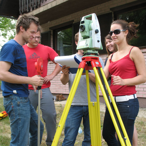
Student field work – land cadastre field
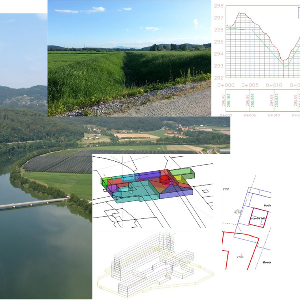
Geoinformation support to the spatial management