1st Cycle Study: Geodesy and Geoinformatics BA
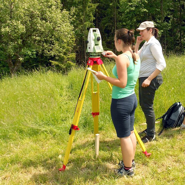
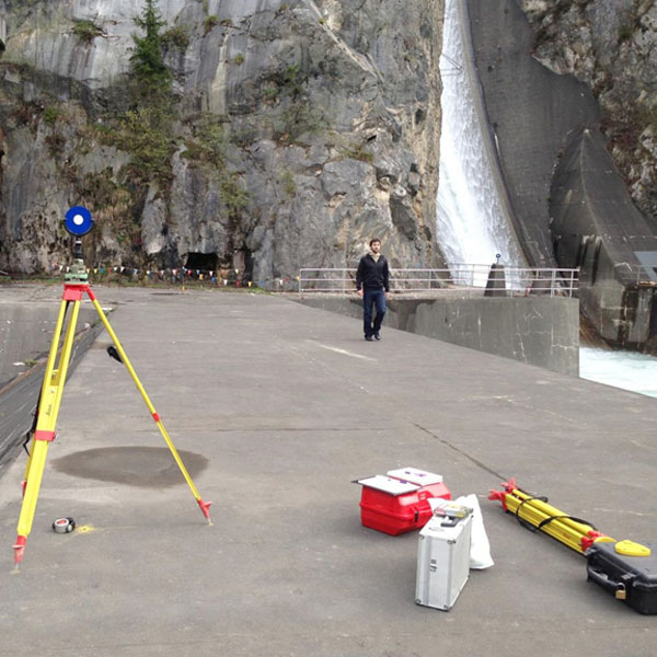
An engineer of geodesy is an expert with academic education, who masters measurements with surveying methods, using different measuring procedures that lean on various technologies. His or her basic task is collecting and processing data on land and geographic features. Surveyor’s task is also research work and discovering new procedures for recording spatial elements.
places for academic study program Geodesy and Geoinformatics (BA)
Basic goals of the programme
The acquired knowledge allows the graduates of the bachelor degree study:
- a broad insight into the historical development and current status of the profession in Slovenia, Europe and beyond,
- to implement and critically assess procedures related to geodesy and geoinformation,
- to further develop and strengthen professional engineering responsibility,
- comparability of the knowledge acquired to similar programs in the region.
General competences
-
- study new technologies and methodologies independently by acquiring the bases of professional responsibility,
- communicate in oral and written form in the native and in foreign languages with special emphasis on the knowledge of foreign language terminology,
- use information and communication technologies in the fields of geodesy and geoinformation,
- connect with other professionals in working teams of different experts from various professional fields,
- manage a small surveying firm engaged in solving professional problems.
Subject-specific competencies
With the first cycle bachelor study programme Geodesy and Geoinformation the graduate acquires the following course-specific competences:
- knowledge of the role and importance of geodesy and geoinformation in modern society,
- ability to independently solve all kinds of typical surveying tasks in the areas of data capture and quality assessment as well as to make decisions related to the use of spatial information,
- ability to use modern surveying technologies and methodologies to acquire spatial data with appropriate precision or accuracy,
- knowledge of spatial data usage according to their importance, form of records, quality, resources, production and recovery,
- ability to use the measurement results and professional knowledge in:
– maintenance of basic geodetic systems, – less complex building construction,
– administrative procedures to meet the needs of real estate registration,
– participation in planning, design and implementation of interventions in space,
– maintenance of geographic and cartographic systems and preparation of cartographic spatial data, and
– cooperation with investors, designers and contractors.
Knowledge and skills required for the admission to the program
Acknowledgement of knowledge and skills considers:
- certificates and other documents on successful attendance at courses and other forms of education,
- evaluations of products, services, publications and other works by students,
- evaluation of knowledge that student acquired by self-educational process or empirical learning (possibility of performing study duties without active participation at lectures, practical, seminars),
- adequate work experiences.
Based on the approval of the acquired knowledge by the departmental Study Board, the knowledge will be evaluated with the same number of ECTS credit points as defined for the related teaching subject.
Advancement conditions according to the program
Conditions for the advancement from one year to another
A student can enroll in the second year if they have completed the prescribed obligations by the end of the academic year and have earned 52 ECTS credits from the 1st year. The student can enroll in the third year if, by the end of the academic year, they have completed the prescribed obligations and earned at least 50 ECTS credits from the 2nd year, as well as completed all prescribed obligations and earned 60 ECTS credits from the 1st year.
Exceptionally, a student can apply for enrollment in a higher year if they have completed the mandatory content according to the study program, achieved at least 45 ECTS credits in the current year, and have justified reasons. Justified reasons are determined in accordance with the Statute of the University of Ljubljana. The decision on exceptional enrollment is made by the Study Board of the Department of Geodetic Engineering at UL FGG.
At the Faculty of Civil and Geodetic Engineering, we have had an established system of tutoring and mentoring for our students for many years. Students will have their mentors from the first year onwards, and smaller groups of students will also have tutors from the ranks of educators or students in higher years who will assist them in choosing directions, elective subjects, and the like.
A student demonstrating above-average academic results is allowed to progress faster in their studies. The decision on this is made by the dean of UL FGG based on the candidate’s request and the reasoned opinion of the UL FGG Study Board. The decision specifies the method of accelerated progression.
Conditions for repeated enrolment in the same year
Failing to meet all the obligations defined by the study programme for the advancement in the next year, students may enrol in the same year for the second time. They are entitled to the repeated enrolment only once for the duration of the study, provided that they achieve at least 30 credit points according to ECTS.

Requirements for completion of the study
Transfer between study programmes
Transfers are possible from the first cycle study programmes, and until their expiration also from the undergraduate study programmes adopted after June 11 2004, where the competences of the finished studies are comparable and according to the acknowledgement criteria at least half of the obligations according to ECTS from the first study programme related to compulsory courses of the second study programme can be acknowledged. Considering the scope of acknowledged obligations from the first study programme in the Republic of Slovenia or abroad student may enrol to the same or higher year in the second study programme. Transferring students shall fulfil the conditions for the enrolment to the second study programme.
Applications of candidates for the transfer to the first cycle academic study programme Geodesy and Geoinformation and the scope of acknowledged obligations in the study programme will be examined individually by the Study Board of the Department of Geodesy. If in the procedure of acknowledging obligations for the purpose of transfer the candidate is approved at least the amount of credit points and those point that are required for the enrolment to a higher year of the first cycle academic study programme Geodesy and Geoinformation, the candidate may enrol to the higher year of the first cycle academic study programme Geodesy and Geoinformation.
Methods of Assessment
Knowledge is examined and evaluated in individual courses. Accordingly, the teaching process in each course finishes with the examination of knowledge and acquired skills. The forms of knowledge testing (oral or written examinations, preliminary examinations, seminar works, work logs, practical assignments, projects, portfolios, peer evaluation) are defined in the study plans of individual courses. General rules of knowledge testing are regulated by the Rules on the first and second cycle studies at the UL FGG, adopted by the Senate of FGG. The details are defined by the Study Regulations.
The student receives a single grade of the exam, consisting of foreseen required obligations in each course. Each obligation shall be evaluated with a positive grade.
Knowledge from preliminary and partial examinations, seminars, seminar works, work logs, practical projects, home projects, homework and similar amounts to at least 30 % of the total grade.
According to the Statute of the University of Ljubljana the following grading scale is used:
10 – (91–100 %: excellent: exceptional results with negligible mistakes),
9 – (81–90 %: very good: above average knowledge with few mistakes),
8 – (71–80 %: very good: sound outcomes),
7 – (61–70 %: good: good knowledge, but with significant shortcomings)
6 – (51–60 %: sufficient: performance meets the minimum criteria),
5 – (50 % and less: unsatisfactory: performance does not meet minimum criteria).
The candidate's performance is considered successful for grades from satisfactory (6) to excellent (10).
Possibilities of elective courses and mobility
Student may transfer 30 credit points of the program (one study semester, regardless of mandatory and elective units) from any other area of geodesy and geoinformation, provided (if exists) an adequate agreement signed with UL FGG.

Study programme courses – Geodesy and Geoinformation (BA)

All study programmes on Faculty of Civil and Geodetic Engineering are internationally certified from 2015 to 2021.
