
EO Browser, the world’s most popular satellite imagery viewer, has recently been made available in Slovenian.
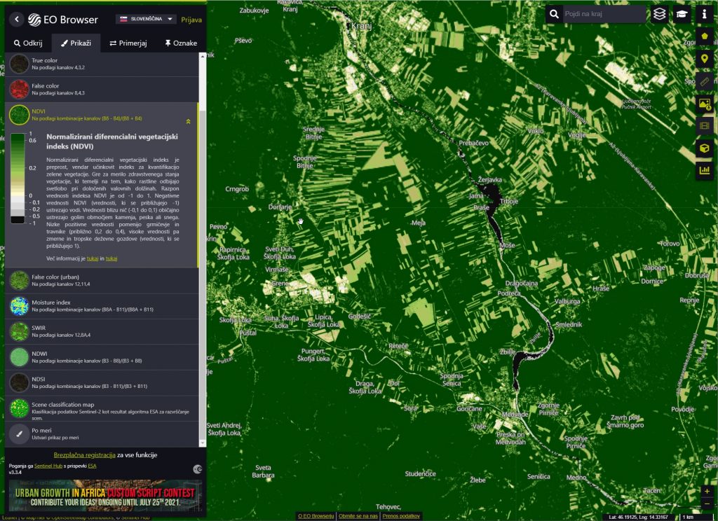
Viewing images with different visualisations and descriptions. The image shows the NDVI vegetation index.
The EO Browser, developed by Sinergise d.o.o., makes it fast and easy to browse and compare full-resolution satellite imagery from many sources (Copernicus Sentinels, Landsat, MODIS, commercial sources, etc.). You can select the area of interest, specify the desired time range and cloud coverage, and view the resulting data in the browser. In addition, you can try out different visualisations, create your own, download full resolution imagery, and create time-lapse animations.
The EO Browser is based on the Sentinel Hub service, allowing access to data via a browser, a desktop GIS application, or an API. Of particular interest for education is the education mode, where twelve themes can be explored with selected interesting locations and visualisations. This is perfect for students and teachers or anyone interested in exploring the surface with satellite data. EO Browser images can be displayed based on the user’s configuration, defined by simply dragging and dropping spectral bands into RGB channels, or with simple scripts. Many visualisations are prepared with legends and descriptions such as true colour, false colour, NDVI and EVI vegetation indices, etc.
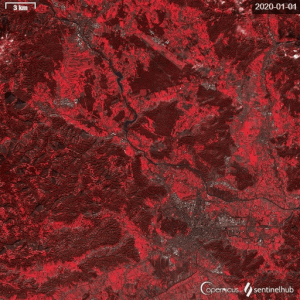
This image shows the Sentinel-2 satellite image sequence for 2020 over a whole year. We can see the evolution of vegetation, the change in agricultural land and water. The animation is shown in artificial colours (IR, red and green), using only low cloud imagery.
EO Browser is free to use. You can try it here.
The Slovenian translation was provided by Prof. Krištof Oštir.