
Bujar Fetai is the newest L3Harris Geospatial Student Spotlight.
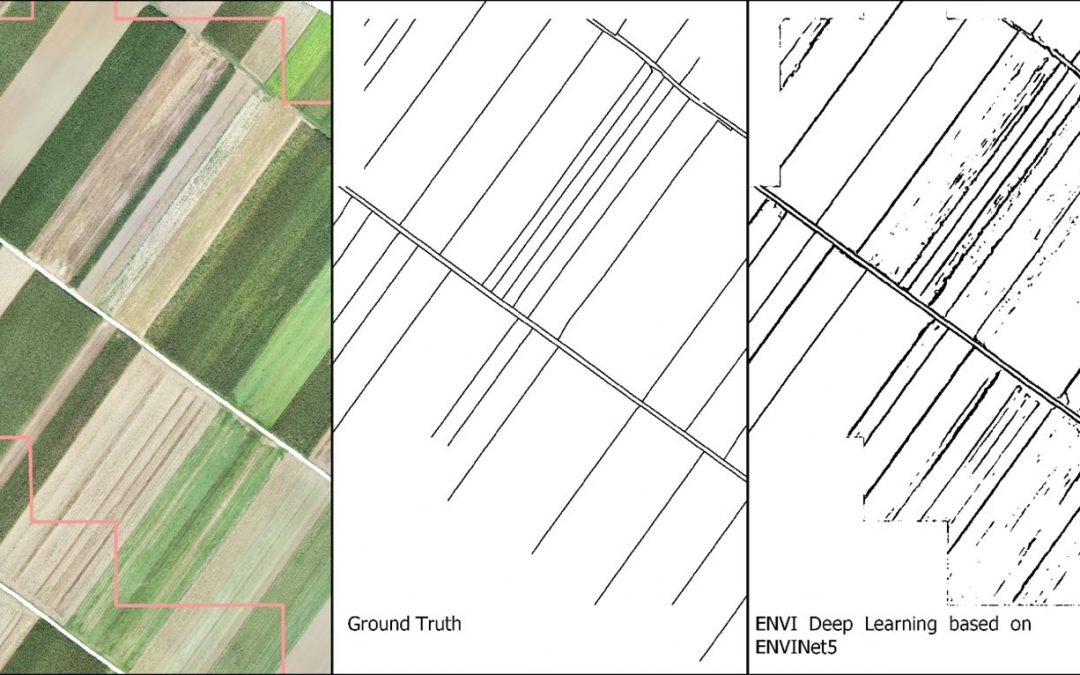
As part of his PhD, he is working on automating the process of delineating visible land boundaries from UAV imagery. Fetai’s research on visible land boundary detection with ENVI Deep Learning was recently published in Remote Sensing for Land Administration 2.0. (Fetai, B.; Račič, M.; Lisec, A. “Deep Learning for Detection of Visible Land Boundaries from UAV Imagery” https://doi.org/10.3390/rs13112077).
The application of deep learning for visible cadastral boundary extraction is becoming increasingly important, especially for UAV-based cadastral mapping. As part of his PhD thesis, Fetai used deep learning to automate the extraction of visible cadastral boundaries from UAV imagery. In terms of deep learning, ENVI plays a crucial role and can be considered as a rigid mapping approach that does not require programming. The latter is very important as not all land administrators or managers have programming skills and ENVI Deep Learning is a great alternative.
Boundary maps predicted with ENVI Deep Learning could be used in developing regions with low cadastral coverage to speed up cadastral mapping. This will be particularly useful in rural areas where the visibility of cadastral boundaries on images is higher, compared to dense urban areas. In more developed regions where a complete cadastre already exists, ENVI Deep Learning could be used to automate the revision of existing cadastral maps to automatically define areas where cadastral maps need to be updated.
More at Student Spotlight Fall 2021.